
Egypt prioritises Miocene hydrocarbon exploitation in the eastern Mediterranean West Offshore Nile Delta (WOND) licence. This study integrates Amplitude Versus Offset (AVO) analysis with machine learning to improve prospect identification and reduce exploration risk. Deterministic geophysical interpretation and data-driven modelling using Gradient Boosted Decision Trees (GBDT) and neural networks identify seismic abnormalities and predict subsurface facies.
AVO analysis interprets amplitude and polarity shifts to find direct hydrocarbon indicators (DHIs) and classify anomalies into AVO Classes II, IIp, and III. Additionally, machine learning can discover subtle gas-charged sands by collecting complicated, non-linear connections between seismic properties and well log data. Rock physics study, including 85% gas substitution scenarios, proves the workflow’s robustness.
The findings identify gas sands with AVO Class II responses and good porosity and low acoustic impedance contrasts. These traits appear as soft amplitude anomalies in near-angle stacks and increasing amplitude brightness in far-angle stacks. Gas sand probability volumes using machine learning match seismic amplitude readings, boosting interpretive confidence. Application to WOND Miocene and Pliocene case studies confirms the workflow’s ability to define prospective reservoirs and reduce uncertainty.
This combined AVO and machine learning system strengthens subsurface characterisation in geologically complicated environments, aiding offshore basin exploration and development decisions.
Introduction
The WOND licence is situated 100 km offshore from Alexandria city in the Mediterranean Sea, covering an area of approximately 1800 km2 enclosed in a rectangle 70 km (inline, NE-SW), and 20 km crossline (Figure 1).
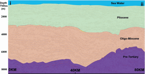
The geological deposits within the WOND licence consist of sandstones and mudstones arranged in fining-upward composite patterns, indicative of a channelised depositional system. The geological deposits are made up of significant net volume sands (Cross et al., 2009).
The WOND licence has certain important geological features, such as the Rosetta fault, which runs from the northeast to the southwest, the Nile Delta Offshore Anticline (NDOA), which runs from the east-northeast to the west-northwest, and fault blocks that have rotated northeastward along the licence boundary (Ahmed et al., 2001). The Upper Pliocene channels’ depositional geometries, on the other hand, are not influenced by these significant structures. The thickness and sedimentation patterns across them stay the same (Samuel et al., 2003).
There are around 20 exploration and appraisal wells and more than 80 development wells in the study area. These fields exhibit bright amplitudes in far-angle stacks, (Othman et al., 2021). The production zones extend to a depth of only 3 km true vertical depth below mudline (TVD BML) and include the Upper Pliocene (Figure 2).
Seven failure cases were also observed in the region. One exploration well tested for AVO class IIp gas sand within the Pliocene level but encountered brine sand. A precisely focused Messinian non-clastic formation revealed an absence of sand. The remaining wells, drilled in the Miocene section based on geological models, encountered water sand (Monir and Shenkar, 2016).
This paper builds on insights gained from two earlier studies conducted in the West Nile Delta. The first study applied artificial neural networks (ANN) to identify low-amplitude, impedance decrease (soft kick) gas prospects within the Upper Messinian section, demonstrating the effectiveness of artificial neural networks (ANN) in detecting subtle seismic anomalies (Abd-Elfattah et al., 2025). The second study extended this approach to the deeper Miocene interval, targeting similarly elusive low-amplitude responses (Fahmy et al., 2025). Building upon these foundations, the current research focuses specifically on the concept of ‘invisible sand’ gas-charged reservoirs with impedance values nearly identical to the surrounding lithology, making them challenging to detect using conventional interpretation techniques. To address this, the study employs an advanced machine learning algorithm that integrates seismic attributes, rock physics modeling, and well data to enhance the classification and de-risking of these subtle targets. This workflow aims to improve hidden prospects identification and reduce exploration uncertainty in complex deepwater settings.

