
This paper presents three case studies from the Azeri-Chirag-Gunashli (ACG) field, focusing on the modelling of 4D amplitude anomalies caused by dynamic reservoir changes. The first case study examines the evolution of softening in the Fasila B reservoir, highlighting the impact of gas saturation on seismic attributes and the importance of 4D modelling in understanding these changes. The second case study addresses the hardening observed in the Balakhany reservoir, visualising the impact of sweep thickness on amplitude response and the resolution capabilities of 4D seismic data. The third case study shows how 4D modelling helps during the processing campaign, by validating observed 4D anomalies. These studies underscore the critical role of 4D seismic modelling in interpreting anomalies observed in actual 4D seismic data, improving dynamic reservoir characterisation, and guiding decision-making during seismic data processing. The findings also highlight the need for realistic expectations about how dynamic reservoir processes impact noise-free seismic data, particularly in the context of identifying fluid movements.
Introduction
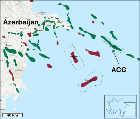
This paper presents three case studies from the giant, 50-km-long Azeri-Chirag-Gunashli (ACG) field located in the South Caspian Basin (Figure 1). These studies focus on modelling 4D amplitude anomalies caused by fluid and pressure changes in the reservoir.
Seismic acquisition at ACG has focused on improving static and dynamic reservoir imaging, advancing structural understanding through higher-resolution data, and enhancing dynamic insights with field-wide 3D and 4D surveys over 30 years (Howie et al., 2005).
The ACG field is an elongated anticlinal structure with steeply dipping limbs and three structural peaks: Azeri, Chirag, and Gunashli. Production began in 1980 at the shallow-water northwestern end of Gunashli. The remainder of the field, operated by bp on behalf of the Azerbaijan International Operating Company (AIOC), commenced production in late 1997.
The main production intervals stratigraphically correspond to the Productive Series shown on the generic type-log in Figure 2. The Productive Series is a set of multiple stacked reservoirs of fluvio-deltaic origins, located at depths of 1800-3400 m. The series was deposited during a time of lowered basin levels, leading to large sediment deposits from the paleo-Volga River into the northern region of the isolated, lacustrine South Caspian Basin (Reynolds et al., 1998; Green et al., 2009).

