
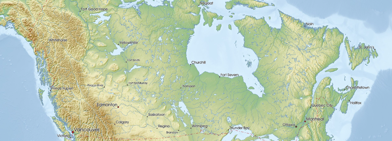
Recent Canadian exploration programmes illustrate three contrasting applications of seismic data: structural mapping for natural hydrogen in Nova Scotia, ambient-noise tomography for mineral targeting in Québec, and iterative seismic-to-well calibration at a hydrogen prospect in Saskatchewan.
Natural-hydrogen and mineral explorers are adapting established seismic workflows to geological systems in which the exploration models—and therefore the relationships between measured physical properties and the target resource—remain comparatively uncertain.
Projects in Nova Scotia, Québec and Saskatchewan demonstrate how active 2D reflection seismic, passive ambient-noise tomography and integrated 3D seismic interpretation are being used to constrain structure, rank targets and guide drilling. They also underline the importance of distinguishing geometrical or velocity anomalies from evidence of an economically recoverable accumulation.

Structural imaging for natural hydrogen in Nova Scotia
Québec Innovative Materials Corp. (QIMC) is preparing an approximately 42 line-km 2D seismic programme across the Bennett Hill–Apple River corridor in Nova Scotia. It forms the larger component of a 78 line-km campaign covering the company’s natural-hydrogen interests in Nova Scotia and Québec. Echo Seismic will acquire nine lines across five target areas using approximately 1400 INOVA Quantum channels, 5-Hz geophones and 25-metre receiver spacing. Vibroseis acquisition will follow the existing road network. The geometry is designed to investigate relationships between two drilling centres approximately 15 km apart, surface hydrogen and helium anomalies, interpreted faults and shear zones, basement contacts and regional Cobequid structures. Five boreholes provide geological tie points, while the wider interpretation will incorporate approximately 6000 soil-gas samples, ground magnetics and structural mapping.
The sequence differs from a conventional reconnaissance seismic-first workflow. QIMC drilled before acquiring seismic because the district lacked legacy well control and hydrogen-focused seismic coverage. The resulting borehole information can now be used to calibrate the profiles and place point measurements of hydrogen at depth within a district-scale structural interpretation.
The principal targets are faults, shear zones, basement relief and structural intersections that may control migration and accumulation. The nine-line layout should improve structural understanding along the corridor, although the limitations of a road-constrained 2D geometry—including out-of-plane energy and ambiguity between intersecting structural trends—will need to be considered.
The intended outcome is not direct identification of hydrogen-bearing reservoirs, but a better-constrained framework for selecting locations for characterisation drilling, pressure testing and flow testing.
Ambient-noise tomography at Montauban
ESGold has completed a second phase of ambient-noise tomography at its Montauban gold-silver project, approximately 120 km west of Québec City. The ANT-2 programme used 200 three-component stations at average spacings of approximately 400–600 metres. Continuous data were recorded for 32 days and processed into a 3D shear-wave velocity model evaluated across 1251 grid nodes. The company reports useful geological constraint between approximately 86 metres and 1.2 km depth. The interpretation includes broad, near-horizontal low-velocity zones and narrower, near-vertical corridors trending approximately 020°.
The geophysical results have been incorporated into a property-scale model covering approximately 70 km². The supporting database includes 1637 drillholes, 1707 multi-element samples, lithological information, historical assays, structural interpretations and regional mapping. This integration is particularly important at Montauban, which ESGold interprets as a structurally modified, gold- and silver-rich volcanogenic massive sulphide system. Folding, faulting and deformation may have displaced or repeated favourable units and mineralised horizons, making a purely stratigraphic targeting model inadequate.
The near-horizontal velocity features are being evaluated as possible lithological packages, while the steep corridors provide a framework for investigating deeper structural controls. ESGold has appropriately noted that these anomalies are not interpreted as mineralisation in isolation. Their relevance depends on coincidence with favourable lithology, known mineralised trends, drilling results and zinc, copper, barium and silver geochemical responses.
For target generation, ANT therefore functions as a low-impact source of volumetric velocity information rather than a standalone detector. Its value lies in updating the structural and lithological framework within which the more diagnostic geological and geochemical observations can be assessed.
Iterative seismic and well calibration at Lawson
MAX Power’s Lawson project in Saskatchewan presents a more advanced seismic-to-drilling workflow. Legacy 2D seismic was used to select the original exploration target. Following the initial well, the company acquired a 47 km² 3D survey to refine trap geometry, fault architecture, reservoir distribution and depth conversion. Preliminary interpretation defined an approximately 14.2 km² structural closure within a broader 28 km² area designated the Lawson Complex. The 3D volume was subsequently used to position follow-up wells around the interpreted apex and flanks of the structure.
The Lawson-4 well reached a measured depth of 2400 metres. According to MAX Power, it encountered a 20.5-metre interval with indications of permeability and porosity between 2290 and 2310.5 metres in basal Cambrian sandstone, immediately above Precambrian basement and a structure interpreted as a deep crustal fault. The following 30.9 metres included mafic and ultramafic basement rocks, fracturing and elevated hydrogen readings. The working model links potentially hydrogen-generating basement lithologies with fault-controlled migration, a basal Cambrian reservoir and regional evaporitic sealing.
The programme increasingly resembles an iterative reservoir-characterisation loop. Seismic interpretation guides well placement; drilling and core data update the geological model; and the revised model is used to rank further targets. MAX Power is combining 2D and 3D seismic with core observations, gas measurements, geochemistry and regional datasets in an AI-assisted large earth model.
Lawson-5 is planned approximately 30 km to the northeast, towards the margin of the Prairie Evaporite. This represents a substantial step-out from the existing well cluster and will test both the proposed regional extent of the system and the interpretation of the evaporite margin as a trapping element.
The remaining uncertainties are material. Seismic can constrain geometry and guide the sampling of prospective intervals, but it cannot establish hydrogen origin, charge, preservation or economic deliverability. Gas composition, sustained flow, pressure response, reservoir connectivity and volume still require completion testing and independent evaluation.
Measurement must follow the geological question
These projects apply seismic methods at different scales and stages of exploration.
In Nova Scotia, sparse 2D profiles are intended to connect borehole observations and surface anomalies to a regional structural framework. At Montauban, passive data contribute a 3D shear-wave velocity model to a heavily drilled and geochemically sampled mineral system. At Lawson, 3D reflection seismic is already operating within an iterative drilling and appraisal workflow.
The common constraint is non-uniqueness. Reflection geometry, velocity anomalies and structural closure can reduce geological uncertainty, but none is diagnostic of hydrogen charge or mineralisation without independent calibration. This is especially important in natural-hydrogen exploration. A 2026 scientific review involving the US Geological Survey identified uncertainties throughout the system—from generation and migration to accumulation, preservation and recoverability. It recommended integrating seismic with magnetic, gravity, electromagnetic, geochemical and borehole information rather than relying on a single response. The review also highlighted the need to exclude near-surface biological production, drilling artefacts and borehole corrosion when interpreting hydrogen measurements. For emerging hydrogen plays, rigorous validation of the gas signal is as important as imaging the structure intended to contain it.
The expansion of geophysics into these resource domains is consequently less about transferring individual technologies than about transferring integrated interpretation and uncertainty management. The decisive test will be whether these measurements lead to better drilling decisions—and whether subsequent wells validate the geological models built around them.
Sources
QIMC’s Nova Scotia survey announcement
ESGold’s Montauban survey results
USGS review of natural-hydrogen uncertainties
MAX Power’s Lawson drilling update · Lawson 3D seismic results
Image courtesy of mapswire.com

