
by Satinder Chopra
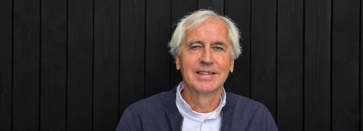
Paul de Groot is a true pioneer whose work has fundamentally shaped how the industry approaches seismic interpretation, quantitative workflows, and subsurface AI.
Paul holds both an MSc and a PhD in Geophysics from Delft University of Technology. Over a distinguished 45-year career, starting at Shell, continuing through TNO, and culminating as co-founder, former CEO, and Special Adviser at dGB Earth Sciences, he has led and supervised world-class interpretation projects across nearly every major basin globally. His technical footprint spans acoustic and elastic impedance inversion, sequence stratigraphy, 4D monitoring, and the creation of industry-standard tools like OpendTect.
Beyond his project portfolio, Paul is widely recognized as one of the original architects of digital geosciences. Long before artificial intelligence became a mainstream industry buzzword, he was pioneering machine learning applications, co-authoring a seminal textbook on soft computing in the oil industry, and co-inventing a patented methodology for semi-automated seismic object detection. His extensive publication record, spanning horizon tracking, Wheeler transformations, diffraction imaging, and machine learning, reflects a lifelong commitment to bridging fundamental geology with cutting-edge computation.
What makes Paul uniquely suited for this interview is not just his technical expertise, but his frontline perspective on the evolution of our discipline. Having personally transitioned through every major paradigm shift in seismic interpretation, from manual horizon timing on paper to interactive workstations, and now to machine-assisted quantitative workflows, he brings an unrivalled depth of insight into where the industry has been and where it is heading next.
Paul, could you tell us a little about your educational background and take us through your professional journey? What were the key turning points that took you from being an early-career geophysicist at Shell to your various roles at dGB Earth Sciences?
I studied Mining Engineering at Delft, specializing in Geophysics. After graduating with an MSc in 1981, I was hired by Shell, working at their Rijswijk laboratory before transferring to Oman as a processor and quantitative interpretation specialist. This experimental environment taught me that R&D thrives on creative freedom and initiative—foundational values we later adopted at dGB. My next posting to Nigeria as an interpreter coincided with the industry's shift from paper sections to digital workstations, sparking my lifelong passion for software development. However, when Shell later transferred me to a standard head-office support group in The Hague, I felt my career was derailing and decided to take back control.
In 1991, I resigned to start Quest Geophysical Services. It was a reckless leap of faith; I had a family with four young children to support, no clients, and no business plan. All I had was a prototype program proving that neural networks and pseudo-wells could characterize seismic reservoirs. Fortunately, TNO partnered with me to secure funding, which culminated in 1995 with a Ph.D., a working prototype, and the founding of "de Groot-Bril Earth Sciences" alongside Bert Bril, a brilliant software architect and my wife, Mieke, as office manager. We quickly rebranded to dGB Earth Sciences so international clients could pronounce our name.
The early years were lean, but we successfully launched GDI, our first specialized commercial software. A massive turning point arrived in 1998 when Statoil (now Equinor) approached us to automate their tedious manual mapping of fluid migration paths. Together, we developed the ChimneyCube. It was an instant success, allowing geoscientists to trace migration paths from source to trap and directly de-risking charge and seal problems—two of drilling’s greatest uncertainties.
Statoil then funded d-Tect so their teams could apply this technology. We launched it in 2000 as a closed-source system, but soon realized clients bought it for niche functionality rather than bread-and-butter mapping. To rapidly scale our user base, we made the bold decision in 2003 to pivot to a freemium model. We split the platform into OpendTect—a fully functional open-source core system under a GPL license—and OpendTect Pro for commercial plugins. This ecosystem approach expanded our global footprint, kept the company healthy, and ensures we are still tackling the industry's most challenging projects today.
You have devoted your entire career to geophysics. What initially attracted you to the discipline, and what has sustained your passion for it over the years?
What initially drew me to geophysics—and what still excites me today—is the sheer joy of experimentation and the challenge of solving complex problems in entirely novel ways. To me, the ultimate beauty of this discipline lies in its deeply multidisciplinary nature. A great geophysicist cannot afford to work in a silo; you must build a fluid understanding of geology, rock physics, statistics, mathematics, computer science, and, increasingly, artificial intelligence.
Because it sits at the intersection of so many fields, geophysics is constantly reinventing itself. It is a domain of continuous innovation. When I look back at where we started, working with coloured pencils on paper sections, and compare it to the advanced AI-driven workflows and open-source ecosystems we use today, the transformation is staggering. Having the opportunity to actively contribute to that evolution, rather than just witnessing it, is exactly what has sustained my passion over a career spanning more than four decades.
Looking back on your career, what would you say have been the principal aspirations and motivations that have shaped you as a geophysicist?
At my core, I am driven by an innate curiosity and a relentless desire to test boundaries and see if things can be done better. Throughout my career, I have never been content with just accepting standard industry workflows if I perceived there was a more elegant or accurate way to increase our understanding of the subsurface. This motivation is what pushed me from the safety of a corporate career at Shell into the uncertain world of entrepreneurship. It wasn’t about building a massive empire; it was about controlling my own destiny, working on complex problems, innovating, and delivering practical tools that genuinely improve how geoscientists work. These principles have shaped my entire journey.
“The ultimate goal of any seismic interpretation is to translate data and observations into a realistic, internally consistent geological model.”
Over your 45-year career, you have witnessed seismic interpretation evolve from manual, paper-based interpretation to interactive workstations, machine-assisted workflows, and now AI-driven approaches. What fundamental principles of seismic interpretation have remained unchanged through all these technological developments?
While the tools have evolved dramatically, the core philosophy has not changed at all: the ultimate goal of any seismic interpretation is to translate data and observations into a realistic, internally consistent geological model.
Technology has fundamentally changed the speed and scale at which we operate. Workstations allowed us to look at 3D volumes instead of 2D lines, and AI now allows us to automate repetitive tasks and extract subtle patterns from massive data sets that the human eye might miss. However, the data itself is still just a remote measurement of physical properties.
“AI can find correlations, but only a human geoscientist can determine if those correlations make geological sense.”
Whether you are using a coloured pencil on paper or a deep learning algorithm on a workstation, the geoscientist must still apply sound geological principles—like understanding depositional environments, structural mechanics, and fluid dynamics—to validate the results. AI can find correlations, but only a human geoscientist can determine if those correlations make geological sense. The machine is an assistant; the responsibility to deliver a realistic subsurface model remains unchanged.
As AI becomes increasingly integrated into geophysical workflows, where do you believe, the human geoscientist will continue to add the greatest value?
AI is fundamentally revolutionizing the way we work, unlocking the ability to analyze and integrate vast amounts of data at unprecedented speeds. However, AI models are inherently prone to "hallucinations"—generating patterns or features that look plausible but are entirely ungrounded in physical reality. Furthermore, AI will always produce an answer, regardless of the data quality. If a model is fed flawed or incomplete information, the output will inevitably be flawed; the classic rule of "garbage in, garbage out" applies now more than ever.
This is precisely where the human geoscientist adds the greatest value. Humans must remain firmly in charge of directing the technology and rigorously quality controlling the results. This critical oversight cannot be automated. It requires a geoscientist who possesses a deep, intuitive understanding of the geosciences to spot geological impossibilities, and who combines this with a strong grasp of AI technology to understand how and why a model reached a specific conclusion. The future belongs to the hybrid geoscientist who acts as the ultimate gatekeeper of scientific truth.
In your early work, you argued that quantitative machine-learning workflows should work directly with seismic amplitudes rather than relying primarily on derived attributes. With the subsequent development of deep learning and modern neural-network architectures, how has your thinking about attributes versus raw seismic data evolved?
Seismic attributes are highly valuable for data visualisation and integration, but they inherently carry less information than the raw amplitudes from which they are derived. My argument has always been that if you want to characterize a reservoir interval from seismic data, you should use a machine learning technique that utilizes all available information. In this context, "all information" means the raw seismic waveform within a time gate covering the reservoir, plus half a wavelet above and below it.
This principle is deeply rooted in the classic convolutional model. If you instead feed derived attributes into a network, you are intentionally stripping away information before the process even begins. It is far better to provide the raw amplitudes and let the network determine the optimal mathematical transformation to reach the target output.
This does not mean we never relied on attributes as inputs. For example, our default attribute set for creating the seismic ChimneyCube contained 36 distinct attributes. The reason we relied on attributes back then was scale: a network needs to evaluate a much larger spatial volume of seismic data to accurately classify a complex feature like a fluid migration path. The simple Multi-Layer Perceptron (MLP) networks of that era simply could not handle raw amplitude volumes of that size.
Modern deep learning models can. Today, the same core principle applies: all the foundational information resides in the raw seismic amplitudes, and I do not believe adding a derived attribute adds any real value to a modern architecture. (The emphasis here is strictly on "derived," as adding independent, non-seismic inputs—like well logs—absolutely adds value). In a modern deep learning model like a U-Net, the traditional role of hand-crafted attributes has been completely taken over by the multi-scale features that the CNN layers automatically extract.
You have worked extensively on applying pretrained machine-learning models to new seismic surveys. What are the biggest challenges in transferring a model from one survey or basin to another, and how can they best be addressed?
I am a strong advocate for pre-trained models. While you obviously cannot expect the exact same model to perform flawlessly across every unique dataset, many geological problems are generic and manifest with highly similar seismic features across different basins. From a commercial and operational standpoint, applying a pre-trained model is an obvious choice: applying it is easy, and it generates actionable results in a matter of minutes. The alternative—seismic reprocessing—frequently takes months and comes with a heavy financial cost. If a pre-trained model does not immediately add value to a specific volume, you can simply discard it at virtually no cost.
To address the inherent variations between surveys, our platform “OpendTect Pro–Machine Learning”, fully supports transfer learning and the continuous training of pre-trained models. This means that, in theory, a geoscientist can fine-tune a model to a specific survey or basin. In practice, however, full transfer training is less common. The workflow is naturally more complex and requires a significantly deeper, more nuanced understanding of AI architectures than simply executing an out-of-the-box model. Because of this, the biggest hurdle is not the technology itself, but rather bridging the user capability gap to make model optimisation as seamless as initial deployment.
You have also worked on machine-learning approaches to fault prediction. What have you learned about the risks of training on synthetic data, particularly when the resulting models are applied to real seismic data?
Machine-learning models trained on synthetic data perform remarkably well at predicting faults when applied to data sets characterized by normal faulting and noticeable structural offsets. However, synthetic data alone rarely captures the full, noisy complexity of the real subsurface. Because of this, our premier pre-trained model, Fault-Net, was trained on a robust combination of both synthetic and real-world data. Like many models in this space, it still delivers its sharpest results on normal faults with clear, distinct offsets.
To mitigate the risks of domain gaps when applying these models to real-world seismic data, the workflow matters immensely. In practice, the best results are often achieved by pre-conditioning the input data using an edge-preserving smoothing filter to improve the signal-to-noise ratio without destroying the fault boundaries. In structurally complex or non-traditional geological environments, out-of-the-box pre-trained models can struggle. To address this, the model must be adapted, which is best handled through targeted transfer training on a carefully selected subset of manually interpreted faults from the target survey.
Your horizon-tracking work has enabled large numbers of horizons to be generated automatically. What do you see as the greatest opportunities, and the greatest challenges, in automating seismic horizon interpretation?
Global Seismic Interpretation—the technique used to compute a dense set of horizons or a Relative Geologic Time (RGT) volume—is something that should fundamentally be executed on every single seismic data set. The benefits speak for themselves. Generating a dense set of horizons allows us to analyse seismic data within a true chronostratigraphic framework, making it the essential instrument for seismic sequence stratigraphy, Wheeler transformations (flattening), and systems tracts interpretation.
Furthermore, slicing through the data directly along these meticulously mapped horizons highlights subtle depositional features that would otherwise remain completely hidden in standard views. Finally, from a reservoir characterisation standpoint, this dense framework facilitates seamless well-to-well correlation and allows us to build significantly more accurate low-frequency models to constrain model-driven seismic inversion algorithms.
The primary challenge, however, remains the same as when we first started pioneering this workflow: how do you compute a dense set of horizons or an RGT volume that flawlessly tracks the seismic everywhere with the absolute minimum amount of human effort? As structural and stratigraphic complexity increases, every automated tracking algorithm on the market struggles. The Holy Grail of automated horizon interpretation continues to be balancing processing automation and intuitive user intervention in highly faulted or stratigraphically complex zones.
You pioneered directive-attribute neural networks for applications such as gas-chimney detection and have subsequently worked with modern CNN-based approaches. What have we gained, and perhaps lost, by moving from carefully designed attributes toward end-to-end feature learning?
This question ties back directly to my earlier point about attributes versus raw amplitudes. The fundamental shift is quite clear: hand-crafted attributes were initially necessary only because of the computational and structural limitations of the Multi-Layer Perceptron (MLP) neural networks available at the time. Today, in modern deep learning models, that manual labour has been beautifully replaced by automated, multi-scale feature extraction embedded natively within the Convolutional Neural Network (CNN) layers. What we have gained is a massive reduction in the time spent manually engineering features, as well as a system that can uncover subtle spatial patterns we might never have thought to design an attribute for.
However, we have not completely abandoned the old methods, and this is where a fascinating practical trade-off comes into play. At dGB, we still create ChimneyCube volumes using the classic workflow: an MLP network trained on meticulously chosen attributes extracted at manually picked locations. While we can absolutely achieve this with a modern CNN, doing so introduces major practical hurdles.
To prevent a deep CNN from overfitting on such complex classification tasks, a geoscientist would need to manually pick a significantly larger volume of training points—making the interpretation phase much more labour-intensive. Furthermore, running an end-to-end CNN volume prediction is computationally intensive and requires significantly more time compared to a lightweight MLP. Moving to end-to-end feature learning gives us incredible power and automation, but we occasionally lose the agility and rapid turnaround times that clever, attribute-assisted shallow networks still provide.
Your work on transforming seismic data into the Wheeler, or geological-time, domain provides another interesting perspective on interpretation. What do you see as the principal benefits of working in the Wheeler domain, and where do the greatest practical challenges arise?
Working in the Wheeler domain shifts our perspective entirely: every horizontal slice along the Z-axis becomes a snapshot in relative geological time. When you slice through a Wheeler-transformed seismic volume sequentially, you are quite literally taking a journey through depositional history, observing the subsurface exactly as it looked at various stages of deposition.
To achieve this, our HorizonCube operates in two distinct structural modes: horizons can either run continuously throughout the volume, or they can terminate when they converge—as they naturally do along unconformities and condensed sections. The latter configuration yields a "truncated" HorizonCube. When we slice through this truncated framework in vertical sections, we can instantly map the true lateral extent of deposition at any given moment in geological time. This makes it straightforward to visualize classic architectural patterns like progradation, retrogradation, and aggradation.
These direct visual observations represent a major advancement for systems tract interpretation. They drastically increase our understanding of the broader depositional history and significantly derisk the exploration of subtle stratigraphic traps.
The greatest practical challenge, however, stems from the human element and industry standards. While the principles of seismic sequence stratigraphy are universally understood, executing the interpretation is notoriously difficult. This difficulty arises partly because competing stratigraphic models place critical boundaries—like sequence boundaries—at completely different positions within the same sedimentary cycle.
Your Total Space Inversion and HIT Cube methodologies make extensive use of Monte Carlo simulation and pseudo-wells. What motivated you to take this probabilistic approach, and what advantages does it provide over more conventional deterministic workflows?
In quantitative interpretation, there is no single workflow that fits every scenario. The optimal choice depends entirely on the type and quality of your data, the geological complexity, the budget, and the project timeline. In simple structural settings, a basic deterministic post-stack inversion might be perfectly sufficient. When you need shear-wave information, you naturally move to pre-stack inversion. The decision is always a balance of extracting the necessary detail within your operational constraints.
In terms of technical sophistication and resolution, our HIT Cube trace-matching methodology sits at the far end of that inversion spectrum. It is a workflow designed explicitly for detailed characterisation at the reservoir scale. We begin by creating a stochastic model of the reservoir interval, including the overburden and underburden, encompassing all relevant rock properties. These properties are tied to elastic parameters via probability density functions or robust rock-physics relationships. Using this framework, we run Monte Carlo simulations to generate tens of thousands of pseudo-wells and compute their corresponding pre- or post-stack synthetic seismic responses.
We then compare thousands of synthetic traces against the real seismic data at every single bin location. Finally, the target reservoir properties are statistically extracted from the best-matching pseudo-wells. This yields high-resolution 3D volumes of rock properties accompanied by explicit, quantifiable uncertainty metrics.
The true beauty of this probabilistic approach is that it seamlessly integrates regional geological knowledge and fully utilizes all available well control—even if those wells lie completely outside the boundaries of the seismic survey. Furthermore, instead of just matching synthetics to real traces, this massive pool of pseudo-wells can be leveraged to train machine learning models.
This was the foundational idea I developed during my Ph.D. research at TNO, which Bert Bril subsequently implemented in our very first product, GDI. It is immensely satisfying to see that this original core philosophy has stood the test of time, evolving into what is now the SynthRock plugin within OpendTect Pro.
You have also worked on diffraction imaging for applications such as injectites and basement fractures. What additional geological information can diffractions provide that may be difficult to obtain from conventional reflection imaging?
Conventional reflection imaging is designed to illuminate continuous, smoothly varying geological interfaces. It inherently struggles with sub-wavelength features where the seismic energy scatters rather than reflects. This is exactly where Diffraction Imaging (DI) steps in. By separating the scattered wavefield from the dominant specular reflections, DI provides ultra-high-resolution images of sharp structural edges and localized point-scatterers.
This makes it a highly effective tool for mapping the highly complex, irregular geometry of stratigraphic features like sand injectites, as well as detecting subtle, small-scale fracture networks in carbonates and crystalline basement that would otherwise be smoothed out or obscured on standard reflection volumes.
We offer diffraction imaging as a specialized service in close collaboration with Moser Geophysical Services. They have pioneered a unique DI workflow called “Customisation to Interpretation (CTI),” which leverages their advanced processing with the visualisation capabilities of OpendTect Pro alongside cutting-edge plugins. By combining our software ecosystem with their specialized algorithms, we can drastically enhance the detectability of these elusive, high-value geological targets for our clients.
You have been a strong advocate of open-source geoscience software through OpendTect. What was the original motivation behind that philosophy, and how important do you think open-source development will be to the future of geophysical technology?
From a business standpoint, transitioning to a freemium model has been incredibly successful for dGB. While a conventional, closed-source model might have offered different short-term financial metrics, it would have restricted our reach. Today, it is immensely satisfying to know that OpendTect’s open-source core engine is actively used by thousands of geoscientists worldwide for commercial projects, corporate R&D, and personal exploration under the GPL license. I am equally proud of our academic licensing program, which grants universities complimentary access to OpendTect Pro and its commercial plugins. Combined with our public datasets like the F3-Demo and structured training materials, this initiative plays a vital role in educating the next generation of geoscientists.
Looking ahead, the quality of open-source geoscientific tools is accelerating rapidly, driven largely by agentic AI coding capabilities. This democratisation is a compelling shift to watch, and I am confident OpendTect will continue to play a transformative role in this landscape. Our platform has always been a unique sandbox for people who love to experiment and push boundaries. This philosophy is more relevant than ever with the rise of AI-assisted development and "vibe coding." Because our core codebase is entirely open-source on GitHub, researchers and programmers don't have to build an environment from scratch; the infrastructure, 3D visualisation, and data access layers are already fully built. OpendTect serves as the ultimate playground for next-generation R&D, allowing innovators to focus entirely on their novel ideas, prototype overnight, and plug directly into real-world seismic data.
“The transformative impact of AI on seismic interpretation will not be driven by a single new algorithm, but rather by the evolution of AI from a passive tool into an autonomous collaborator.”
Looking ahead, what developments in AI and machine learning do you think are most likely to have a transformative impact on seismic interpretation over the next five to ten years?
When looking at the five-to-ten-year horizon, the transformative impact of AI on seismic interpretation will not be driven by a single new algorithm, but rather by the evolution of AI from a passive tool into an autonomous collaborator. We can view this trajectory across three distinct phases of development, culminating in a paradigm shift I call ‘Collaborative Interpretation’:
- The Present Phase (The AI Assistant): Today, we are already seeing the widespread adoption of AI assistants. At this stage, the AI behaves like an advanced conversational copilot—answering specific user queries, retrieving data, explaining parameters, or diagnosing software errors on command.
- The Near-Term Phase (The Workflow Agent): In the immediate future, we will transition to Workflow Agents. Here, the AI shifts from answering questions to executing tasks. A geoscientist will be able to define a specific, multi-step workflow—such as pre-conditioning a volume, running fault detection, and extracting horizons—and the AI agent will autonomously plan, script, and execute that end-to-end chain.
- The Long-Term Phase (The Interpretation Agent): Looking further out, we will see the emergence of true Interpretation Agents. These advanced systems will not just blindly execute a script; they will actively observe the intermediate results, geologically evaluate the quality of the outputs against known structural or stratigraphic constraints, and dynamically coordinate or adjust the workflow if anomalies or errors are detected.
Ultimately, the destination of this evolution is a future of Collaborative Interpretation. The role of the human geoscientist will elevate dramatically: instead of spending weeks manually configuring parameters, click-by-click, the geoscientist will act as a strategic director. You will set the high-level geological objective—such as "identify all potential stratigraphic traps in this interval within these economic parameters"—and the AI will orchestrate and optimize the massive, complex workflow required to achieve it, leaving the human to focus on steering, QC, risk validation, and decision-making.
What stands out as the most complex or persistent technical problem you have encountered during your career, and what did you learn from solving it?
Mapping a dense set of horizons or computing an accurate Relative Geologic Time (RGT) volume in highly complex geological settings remains one of the most persistent technical challenges of my career. However, the most profound lesson I learned from tackling this problem was not algorithmic—it was behavioural.
Even if one could design a system that solves this completely automatically, an entirely "accurate" algorithmic solution will still fail to satisfy every geoscientist. Interpretation is inherently subjective. When interpreters quality-control an automated result and decide that they would have mapped a specific fault boundary or horizon boundary differently based on their intuition, they must have the ability to change it seamlessly.
“A powerful algorithm gets you 90% of the way there but empowering the human interpreter to easily manipulate and steer that final 10% is what ultimately determines the success of a technology.”
We quickly learned that providing intuitive, user-friendly editing and override options within a commercial application is more critical to user adoption than the mathematical sophistication of the underlying engine—such as the inversion-based flattening algorithms we use to compute a HorizonCube. A powerful algorithm gets you 90% of the way there but empowering the human interpreter to easily manipulate and steer that final 10% is what ultimately determines the success of a technology.
Let me ask you a philosophical question: You may find yourself in a situation where something seems right, but somehow it doesn't feel right. How do you respond when your intuition tells you that something is not quite right, even when the facts appear to point in the other direction?
Intuition plays a vital role in the geosciences, and its value only grows as one gains experience. The more data volumes, basins, and anomalies an interpreter observes over a career, the faster your subconscious recognizes when something is amiss.
In our line of work—whether dealing with seismic processing, interpretation, quantitative interpretation (QI), or advanced AI workflows—when a result looks technically plausible on paper but simply does not feel right, the probability is exceptionally high that an error was introduced somewhere along the line. It usually means an assumption was flawed, a parameter was slightly off, or data quality was compromised early in the pipeline.
My response in those scenarios is to trust that gut feeling as an analytical trigger. Geoscientists must systematically retrace their steps, reverse-engineer the workflow, and rigorously quality-control the output of every single sequential step against physical and geological expectations. Intuition is not a replacement for facts; it is the internal alarm system that tells you to double-check if your "facts" are actually correct.
Navigating a 45-year career in a highly cyclical industry is an achievement in itself. What would you say is the key to surviving, and thriving, over the long term in the seismic industry?
The absolute key to survival in a highly cyclical industry is the radical flexibility to adapt to changing circumstances. However, flexibility alone is not enough; the precise timing of that adaptation is what ultimately determines an organisation’s success.
If a company anticipates the shifts and pivots at the very beginning of the curve—whether that means embracing digital workstations in the 1980s, adopting an open-source freemium model in the 2000s, or integrating deep learning today—you position yourself to win. If you wait until an organisation waits until it is forced to change, it is already too late, and in this industry, being too late means failure. Thriving over forty-five years requires geoscientists to constantly look ahead, reading the market's macroeconomic and technological indicators so they can jump to the next curve before the current one bottoms out.
How do you like to unwind outside of work? Do you find any interesting parallels between your personal hobbies and your professional approach to scientific problem-solving or teamwork?
I love sports. In my youth, I played soccer, and over the years I transitioned through tennis, running, field hockey, golf, and scuba diving. Today, I primarily stick to tennis and general fitness. Beyond sports, I am an avid reader of thrillers, historical fiction and popular science books, which satisfies my persistent curiosity to see how things work. I also travelled extensively throughout my career and absolutely loved exploring new regions. While I still love travelling, today those trips are exclusively dedicated to holidays with my wife, Mieke. Above all, I am a family man. My greatest joy and the ultimate way I unwind is simply spending quality time with my wife, children, and grandchildren, which keeps me grounded and provides the perfect balance to my professional life.
Finally, what advice or encouragement would you offer to young geoscientists who are just beginning their careers and entering a profession that is changing as rapidly as ours?
I was incredibly fortunate to work with seismic data during an era when technology transformed completely—moving from coloured pencils on paper sections to digital solutions of ever-increasing sophistication. I fully expect that trend of rapid technological acceleration to continue. Translating remote seismic observations into vivid geological realities is a deeply satisfying occupation, and I can heartily recommend it as a career to any young professional entering the field today.
While seismic data were historically the exclusive domain of the oil and gas sector, its applications in mining, civil engineering, geothermal energy, and offshore wind development are growing rapidly. Unfortunately, in Europe today, entering the Exploration & Production (E&P) industry has become unpopular among young graduates. I think that is a profound pity.
The world fundamentally needs secure, affordable, and reliable energy from a diverse array of sources, and each option within our global energy mix comes with its own unique advantages and trade-offs. Oil and gas will continue to play an indispensable role in that mix for decades to come. To young professionals who are hesitant to consider a career in E&P due to social pressure, I would offer this advice: challenge the prevailing rhetoric and analyse whether the public image of the industry matches the scientific and operational facts.
Develop your own capacity for independent, critical thinking. Be fiercely wary of groupthink and the peer pressure that pushes one to accept a specific cultural narrative without questioning it. This is especially true when a narrative is presented with dogmatic assertions like "the science is settled." True science is never settled; it is an ongoing, evolving process of inquiry, scepticism, and empirical testing. Keep an open mind, stay curious, and let the facts guide one’s conclusions.

