
TGS has signed an agreement with the Ministry of Hydrocarbon and Mining Development of the Republic of Equatorial Guinea to create the country's first offshore MegaSurvey, a large-scale multi-client seismic product designed to improve regional subsurface understanding and support future exploration activity.
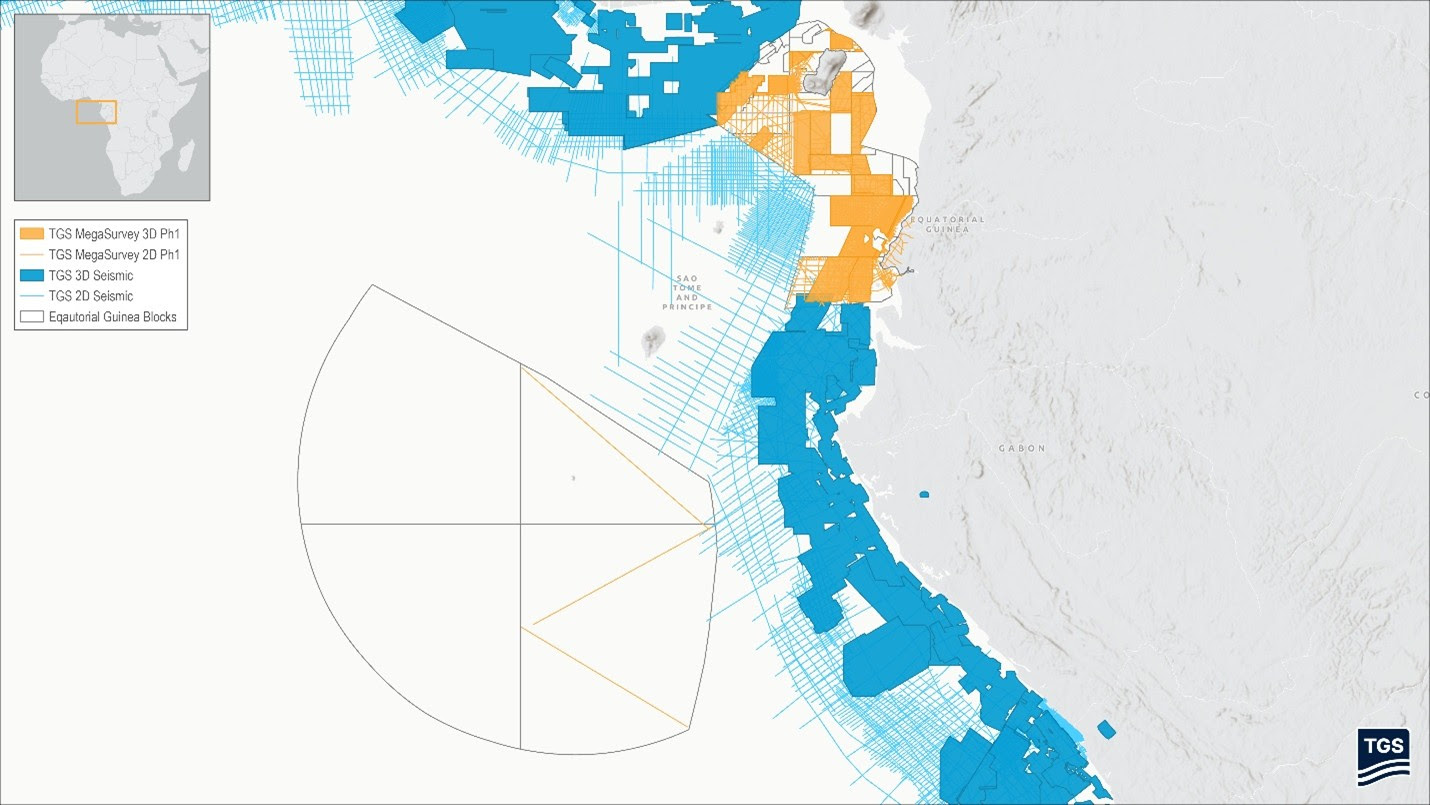
The first phase of the project includes the post-stack reprocessing of approximately 27,273 km of 2D seismic data and around 35,000 km² of 3D seismic data, with completion expected in the third quarter of 2026.
MegaSurveys are harmonised seismic datasets that integrate and reprocess multiple legacy surveys into a consistent regional framework. By providing continuous coverage across large areas, they can improve geological interpretation, enhance understanding of structural and stratigraphic relationships, and help reduce exploration uncertainty.
According to TGS, the Equatorial Guinea MegaSurvey will apply the company's latest imaging technologies to address key subsurface challenges across the Rio del Rey and Rio Muni basins. The resulting dataset is intended to support basin screening, prospect identification, prospect ranking, and future exploration planning.
The agreement represents the first stage of a broader programme to create a seamless seismic data product covering Equatorial Guinea's offshore basins. The long-term vision includes approximately 46,343 line km of 2D seismic data and more than 59,000 km² of 3D seismic data.
David Hajovsky, Executive Vice President, Multi-Client at TGS, said the project would provide explorers with a basin-wide regional screening tool while helping reduce exploration risk through improved subsurface imaging and interpretation.
The initiative also aligns with TGS's wider objective of developing regional seismic products across the Gulf of Guinea, recognising that geological basins extend beyond national boundaries and can benefit from integrated, cross-border datasets.

