
For several decades in seismic reflection imaging, well designed public seismic models and synthetic data have played key roles in numerous seismic technology grand challenges, such as multiple removal, subsalt imaging, marine wavelet corrections, FWI, and more. The models and synthetic data helped clarify an issue, test methods to address it, and demonstrate comparative results to the industry. If asking the right question is ~80% to getting an answer, good models helped define the right question.
I propose that another industry grand challenge that would benefit from a well designed model is the field of addressing bad land seismic shot generated noise in acquisition and processing. Land seismic noise drives most of the cost of land seismic acquisition in noisy areas, it is the main cause of poor images that don’t achieve a desired geologic objective, and it creates much uncertainty that can freeze decision making. Yet, the noise is poorly understood in its cause, its character, its variability, how to address it in acquisition, how to address it in processing, and what is the final effect on the image reliability. Many “crafty” methods have been proposed to address the noise, but it is hard to judge their comparative effectiveness.
Common key questions are “Will a proposed land seismic survey likely achieve the geologic objective?”, “How can I cut costs with land seismic acquisition in a given area?”, “How effective is processing in addressing the noise?”, and “Can FWI solve this problem soon?”
There have been some significant land seismic models & data in the past. But these had some key compromises that we now understand limited their realism in crucial ways. We now understand that ultra-slow shear velocity (~100m/sec) in the top 30m has a huge impact on the coherent noise, yet these models did not have this because it would increase simulation costs by ~100x at the time. If shot generated noise is the dominant feature of land seismic data, a land model should accurately simulate it.
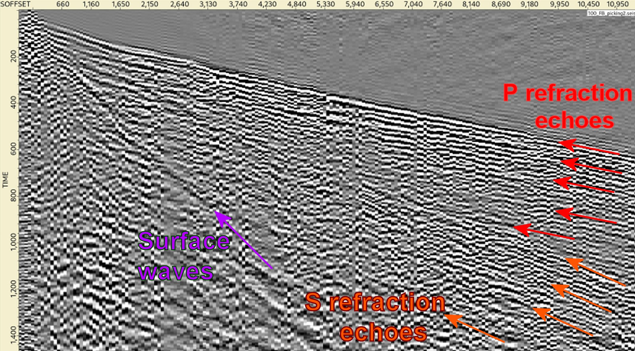
Much bad land seismic shot generated noise has similar characteristics, with the key ones being: 1) The noise has some coherency, 2) the noise is not just slow traveling surface energy, 3) surface waveguide leakage is a major cause, & 4) much of the noise is fast, strong refraction and reflection surface echoes with a bit of irregularity, such as in the figure below. We see this noise behaviour in many areas around the world and it often dramatically degrades image quality and reliability. Surface scattering is a subset of this noise. We see much uncertainty about this ubiquitous strong noise and potential ways to address it in acquisition and processing.
If shot generated noise is the dominant feature of land seismic data, a land model should accurately simulate it.
A new land seismic model and data with realistic noise can help clarify the issues, demonstrate the effectiveness of existing methods, and help focus future development.
I think a good model and data can be produced with limited funding. The question is more how to have it accepted as an industry standard, and how to incentivize the industry to work with the data and show results. A challenge is that the land seismic market consists of diverse smaller companies with limited R&D budgets in both the resource side and the service side, rather than the larger companies in the marine seismic market.
Are you interested in this effort to create a new realistic land seismic model? Do you have any suggestions?
Christof Stork is Chief Scientist at Land Seismic Noise Specialists at Land Seismic Noise Specialists.
Views expressed in this column are solely those of the author.

