
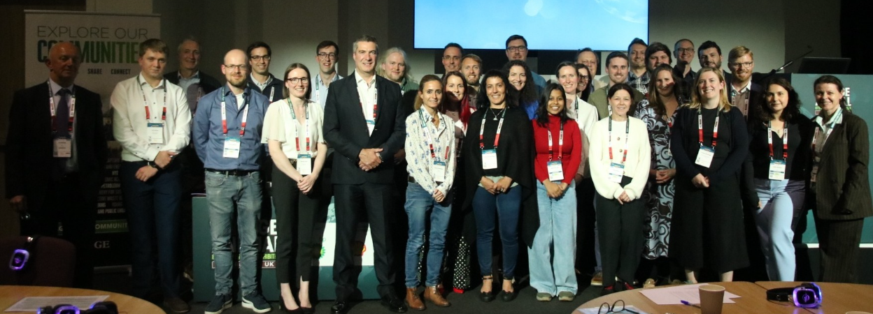
Insights from a workshop held at the EAGE 87th Annual Conference and Exhibition in Aberdeen.
Convenors:
Adriana Comanescu (Vysus Group), Scott Griffiths (Kraken Robotics), Silvia Perez (Fugro) and Bartosz Kurjanski (The University of Aberdeen).
Introduction
The increasing scale of offshore wind developments, combined with the inclusion of more complex environments and a wider water depth range from nearshore to deep water, along with compressed project timelines, continues to place growing demands on marine geoscience and engineering. These challenges require further investigation and improved alignment between stakeholders.
This workshop brought together experts from the industry with diverse specialisms including marine geophysics, geotechnics, and offshore engineering, as well as academics to explore how uncertainty can be reduced, how data can be better integrated, and how emerging technologies are transforming site investigation and risk management of offshore renewable energy projects. Particular emphasis was placed on the detection, characterisation, and management of geohazards and engineering constraints, which remain critical to the safe, efficient, and cost-effective development of offshore wind projects.
Across the sessions, a consistent message emerged: effective offshore wind development depends on early, integrated, and uncertainty-aware ground characterisation, which addresses specific engineering design and installation challenges, supported by advances in imaging, modelling, and multidisciplinary workflows.
The presentations reinforced the workshop’s central theme: understanding past landscapes is essential for anticipating the seafloor and subsurface challenges that govern geohazard risk and engineering performance. To address these challenges, four consecutive sessions focused on geohazards and engineering constraints in the following areas:
- Fixed and floating wind turbine generators
- Export and interconnector cable routes
- Nearshore and landfall
- Lessons learned and future outlook
The workshop was complemented by a field excursion along the Deeside Way, which was organised by the University of Aberdeen and supported by EAGE Wind Energy Technical Community. Participants explored glacial and post-glacial landforms that serve as powerful analogues for offshore ground conditions.
Several key observations and takeaways emerged from the workshop sessions:
1. Integrated Desktop Studies for Offshore Wind
The workshop opened with Simona Caruso (BP) discussing marine geoscience desktop studies and the need for a structured, geohazard and engineering constraints-aware approach to early-stage ground risk management. The presentation emphasised that checking, structuring, and interpreting existing data forms the “first and most influential stage” of offshore ground-model analysis, providing the foundation for all subsequent decisions.
Experience from ongoing offshore wind projects highlighted the value of adapting methodologies from the oil and gas sector, particularly in standardising workflows and improving communication between disciplines. As noted numerous time during the workshop, “the need for approaches conceived from the Oil and Gas industry” has become increasingly evident in current wind developments.
2. Reducing Uncertainty in Offshore Site Investigations
A recurring theme across the workshop was the challenge of reducing uncertainty in site investigations to achieve greater precision in geohazard assessment and engineering constraints, particularly in environments where boulders, mobile sediment, complex stratigraphy, or shallow hazards complicate installation. Peter Cox (RockWave) focused on the role of seismic reflection techniques in identifying subsurface boulders and constraining engineering risk. All speakers stressed that data acquisition and processing workflows must be tailored to site-specific conditions, with 3D imaging offering significant improvements in accuracy and efficiency.
Jordan Geear (Global Maritime) examined the rapid expansion of floating offshore wind (FOW), where deep-water environments introduce new geohazards, engineering constraints and regulatory challenges. Furthermore, experience from the ongoing projects indicates that the late-stage optionality of mooring system selection and site layout decisions are likely. This implies that FOW ground characterisation and geohazard assessment need to allow for large flexibility in micrositing or even relocation FOW turbines. This has significant implications and poses a challenge for scoping and specifying of ground investigations over large FOW lease areas.
A case study from work supporting the Hellenic Hydrocarbons and Energy Resources Management Company discussed by David Vaughn (Cathie) illustrated how early engagement with regulators and certification bodies can streamline project development in deep water settings. This reflects the importance of considering the stage of the wind development project and the scope of the site investigation. While the cost of acquiring 3D data may be justified for detailed investigations at specific, proposed locations, costs at earlier stages can be mitigated by leveraging existing background information and adapting the level of detail to the scale of the study and the needs at that stage (e.g., supporting licensing applications).
3. Shallow Soil Variability and Cable Burial Challenges
Cable burial remains one of the most sensitive and cost-critical elements of offshore wind development. A detailed study introduced by Catriona Macdonald (BGS) of the regional variability of shallow soils in the North Sea demonstrated how changes in strength, density, and grain size directly influence burial depth, cable-soil interaction, and exposure risk. The analysis used open-source geological logs to predict soil behaviour along prospective routes, forming the basis for physical and numerical modelling within the EPSRC-funded project Offshore Cable Burial: How Deep Is Deep Enough?
Complementing this, a paired set of talks explored optimising geophysical surveys for cable routing. Susan Rice (Fugro) reinforced the engineering adage that “you pay for uncertainty one way or another” — either by acquiring sufficient data early, or by absorbing the cost of unforeseen ground conditions at a later, installation and construction stage of the project when the costs are likely to be greater. High-resolution mapping of seafloor features such as bedrock, boulders, and wrecks, together with subsurface detection of layers such as peat and clay, was shown by Leah Arlott (RWE) to be essential for robust route design.
Hannah Smith (DeepOcean) emphasised that for installation contractors, understanding the specific site conditions are fundamental to proper tool selection and cable route engineering. Successful cable installation depends on the early identification, assessment, and management of geohazards, together with a detailed characterization of seafloor and shallow subsurface conditions, to establish the engineering constraints to constructability. A need for an efficient, two-way communication between the survey specialists and installation contractor was highlighted to ensure that acquired geo-data is suitable for engineering and installation of linear assets.
Hannah further pointed out that cable routes, in addition to ground engineering constraints and ground conditions, should be developed accounting for operational factors such as vessel capabilities, lay tension limits, and trenching equipment performance. For example, seafloor gradients and bedforms can create challenges during trenching operations, potentially affecting efficiency, productivity, and long-term cable stability.
The early integration of geophysical and geotechnical data is critical for route development and installation planning. Combining information on seafloor morphology with shallow soil characteristics provides a more complete understanding of the site, enabling informed engineering decisions, reducing installation risks, and improving overall project efficiency.
4. Nearshore and Landfall Challenges
The nearshore zone — where offshore cables transition to land — remains one of the most challenging environments for offshore wind developers. Uneven terrain, dynamic sediment processes driven by the interaction between onshore and nearshore systems and limited access complicate both data acquisition and engineering design.
Chris Brennan (Geo4D/ RS-Geo) examined how unmanned aerial vehicles (UAV) based surveys, combined with LiDAR and high-resolution imagery, can produce detailed terrain models to support landfall planning. Chris highlighted how rapid technological advances now enable efficient acquisition of high-quality data. UAVs can overcome the “uneven terrain and tidal dynamics” that often constrain conventional surveys methods to reduce uncertainty and address potential geoengineering constrain in the critical intertidal zone where marine survey method may not be deployable.
A further presentation by Claire Mcghee (Kent) addressed sediment mobility and its associated impacts, including scour development and sediment redistribution around foundations and cable protection systems (CPS). These processes can expose or undermine cables and, in consequence, reduce their transmission capacity requiring targeted monitoring and adaptive burial strategies. Effective management planning can “reduce operational risk, extend infrastructure longevity, and support proportionate protection measures” in these sensitive zones. However, this requires good understanding of the depositional and erosional processes at the seabed and around structures.
5. The Future of Ground Modelling for Offshore Wind
The workshop concluded with a forward-looking discussion on the evolution of ground modelling. As a large number of fixed offshore wind farms continue to being planned and developed in water depths ~<50 m, the shrinking marine space means that more attention is being played to planned floating offshore wind farms into deeper waters and more complex geological settings. The expectations for quantitative, uncertainty-aware models are rising yet the large scale of FOW projects means that current site survey and ground modelling approaches are not practicable or feasible. This was the topic of the presentation by Vanessa Monteleone (DNV) who updated on the progress of the joint industry project focusing on the development of a robust and uncertainty aware methodology for the development of quantitative ground models. Yet, as was noted during the workshop, there remains a gap between industry expectations and the practical limitations of current methodologies, particularly in how uncertainty is represented and communicated.
A key objective for future practice is to clarify how geophysical and geotechnical datasets can be realistically integrated, and how uncertainty can be tracked from data acquisition through interpretation and into engineering design. Practical constraints — from vessel time to data density — must be acknowledged, however so must the opportunities offered by machine learning, probabilistic modelling, and multi-sensor integration.
The closing presentation by Toby Powell (EvolvEnergies) discussed how the evolution of survey techniques has improved over the last 30 years allowing for imaging of geohazards and geoengineering constraints in unprecedented detail. That said, the goal of data acquisition is to provide the right information (i.e. interpretation of data) pragmatically focusing on the constructability of the asset as a part of an offshore renewable energy system.
Conclusion
The workshop highlighted the rapidly evolving arena of offshore wind ground investigation. From deep-water floating wind to nearshore landfalls, from seismic imaging to UAV surveys, the field is moving toward more integrated, data-rich, and uncertainty-aware workflows.
The insights shared across the sessions reinforce a central message: effective geohazard and engineering constraints interpretation coupled with robust ground modelling is not a technical afterthought but a strategic enabler of safe, efficient, and cost-effective offshore wind development. As the industry pushes into new environments, collaboration across disciplines and across the project lifecycle will be essential.
Acknowledgements
The convenors thank all workshop contributors and participants, as well as the EAGE Annual Meeting organisers. The Deeside Way field excursion was supported by local geological guides whose expertise enriched the workshop experience.

