
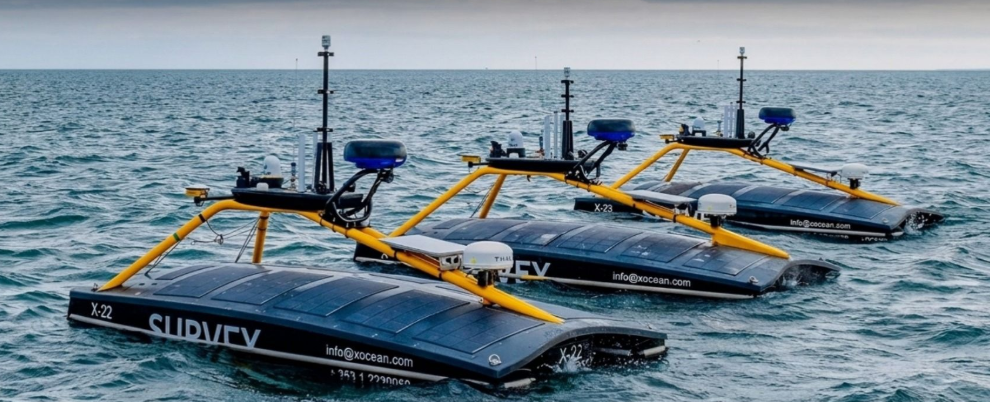
Bellrock Offshore Wind Farm Limited is preparing to begin a geophysical survey within a potential export cable corridor for its proposed floating wind development off the east coast of Scotland.
The survey campaign is expected to begin on 26 July 2026 and require approximately 60 operational days. Work may continue until 30 November, subject to weather and other operational constraints.
A conventional geophysical survey vessel and uncrewed surface vessels will acquire data using hull-mounted and towed survey equipment. A separate vessel will support the uncrewed systems. The survey vessels will require additional manoeuvring space while deploying and recovering towed equipment.
Although the uncrewed vessels will not carry personnel, they will be remotely piloted throughout their 24-hour operations. Real-time imagery and situational-awareness data will be transmitted by satellite to support remote monitoring and safe navigation.
The resulting data will help Bellrock investigate seabed and shallow subsurface conditions along the potential offshore export cable corridor. Geophysical information is used to refine cable routes, identify seabed features and potential hazards, and support engineering design and environmental assessment.
The proposed Bellrock floating offshore wind farm would be located in the central North Sea, approximately 120 km east of Stonehaven in Aberdeenshire. The project has a proposed generating capacity of up to 1.8 GW and could comprise as many as 120 floating wind turbines.
Electricity generated by the wind farm is planned to come ashore between Findon and St Cyrus before connecting to SSEN Transmission’s proposed Hurlie substation west of Stonehaven. The final offshore cable alignment remains subject to survey results, design development and the environmental impact assessment process.
Source: Notice to Mariners issued by Bellrock Offshore Wind Farm Limited via Kingfisher Bulletin/KIS-ORCA

