
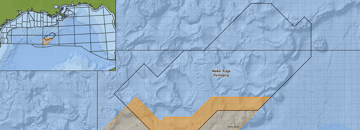
The 4,406 km² extension will apply Time-Lag Full Waveform Inversion to improve subsurface imaging across 189 additional offshore blocks.
Viridien has launched an extension of its Walker Ridge multi-client seismic reimaging programme in the deepwater US Gulf, with fast-track results already available.
Supported by industry partners, the Walker Ridge Reimaging Extension covers 4,406 km² across 189 new Outer Continental Shelf blocks. A further 1,085 km², covering 46.5 blocks, overlaps the original Walker Ridge Reimaging programme.
The combined dataset will provide 5,491 km² of coverage across 235.5 blocks, creating a contiguous exploration volume over an area that Viridien says offers significant infrastructure-led exploration potential.
Infrastructure-led exploration focuses on identifying resources that could be developed using nearby production facilities and other existing infrastructure. Improved seismic imaging may therefore help operators assess smaller, technically complex or previously overlooked opportunities that could potentially be tied back to established developments.
Viridien is applying its advanced Time-Lag Full Waveform Inversion technology to the data. The workflow is intended to improve subsurface understanding and provide greater geological insight in the complex deepwater setting.
The final extension dataset will be seamlessly merged with the original Walker Ridge Reimaging volume, providing clients with a consistent regional dataset across the expanded area. Final results are expected to become available in early 2027.

