
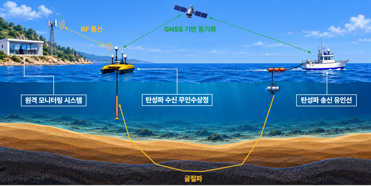
A Korean research team has used an unmanned surface vehicle (USV) to receive seismic data in open water, imaging P-wave velocity structure more than 200 m beneath the seabed.
The Korea Institute of Geoscience and Mineral Resources (KIGAM), working with the Korea Institute of Ocean Science and Technology (KIOST), has demonstrated a marine refraction seismic system designed to extend surveys into shallow coastal areas that can be difficult for large survey vessels to access.
The system separates the seismic source from the receivers. A crewed vessel generates the seismic waves, while a USV carries a compact, low-power receiving and recording system. Data acquisition can be monitored and controlled remotely in real time.

During testing off Pohang, South Korea, the team collected data at five receiver positions along an approximately 4 km survey line. Refraction signals were identified at source–receiver offsets of up to about 2 km. First-arrival travel-time tomography was then used to image long-wavelength P-wave velocity structure to depths exceeding 200 m below the seabed. The results included a relatively high-velocity zone in a shallow part of the survey area.
The demonstration shows how unmanned receivers could help extend seismic coverage into coastal waters where conventional vessel-based acquisition faces operational limits. KIGAM plans to investigate vertical-cable and long-offset reflection surveys using USVs, with a longer-term aim of operating multiple vehicles together.
Image courtesy of the Korea Institute of Geoscience and Mineral Resources

